British weather in August
Dry August and warm, doth harvest no harm.
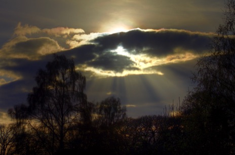
August is statistically the second hottest month of the year, just behind July. Curiously though, the real mega-hot days of the twentieth century were in August (the three hottest days of the century being in 1911, 1932, and most recently and notably 1990; of course, 2003 trumped this, although the very hot days of 2019 and 2022 were in July). August contains the hottest day of the year about 23% of the time (slightly less than June). The hours of daylight are noticeably shorter in August. For me the perfect August day is to wake to dew on the grass; then there will be hours of warm sunshine with the odd cumulus cloud floating around; and a balmy evening full of the fragrance of flowers, before ending with a good overnight thunderstorm. That's how I remember it in childhood, anyhow. But I must be misremembering, because Augusts are getting better. There was a run of pretty dismal Augusts through my childhood, from 1960-1974. And people older than me who remember "the great summers of our youth" weren't right either: the only decent August from 1900 to 1931 was in 1911. On the other hand, the 1990s contained a number of good Augusts, including 1990 (when Britain's highest ever maximum was recorded), and 1995, the hottest on record. In Scotland in August we start to see the first truly dark nights again after the midsummer madness. I always think of Augusts as the month of the moths.
There are supposedly some indications that the month continues with the cyclonic spell that started in late July. The "first storms of autumn" are alleged to lie between 20-30 August, peaking on the 28th. Along with July, it is the least windy month of the year. A very warm July is usually followed by a warm August; the only post-war exceptions to this rule are 1994 and 1999.
We have an abundance of Buchan spells in August: the fifth cold spell (6-11) and the second warm spell (12-15). In many eastern parts of the country (e.g. the Borders, NE England, and in eastern England; also in the levels of Cheshire and Lancashire) August is the wettest month of the year, and in many other eastern places it is the second wettest month. In many places it tends to be the most thundery month. Like July, however, August has tended to become drier, over the twentieth century, particularly recently, and again like July, because of the recent decrease in the frequency of thunderstorms.
Extremes for August in the 20th century
Highest August average overall = 19.2 (1995)
Lowest August average overall = 12.9 (1912)
Highest maxima
38.1 (2003 at Gravesend on 19th; disputed 38.5 at Faversham the same day).
37.1 (1990, Cheltenham on 3rd)
Lowest minimum = -4.5 (21st, Lagganlia, Grampian, 1973)
Some extreme weather events in August in the twentieth century
1901 Mostly changeable, although there was a warm, sunny spell 20-24th. The weather quickly changed as it became cool, wet, and windy.
1902 Edward VII was crowned on 9 August; the day was cool and mostly cloudy.
1903 Cool, very wet and windy at times, with gales midmonth. On the 24th, 70 mm of rain fell at Nottingham.
1905 Storms on the 27th particularly affected Ireland.
1906 A tornado accompanying a thunderstorm killed two people in Guildford on the 2nd. The storms in the south that day were particularly intense. The Great Storm at Little Staughton (North Beds.) gave some hailstones reportedly 5" across, and hailed piled a foot high. The storm approached from the SW and started around 9 pm. An extraordinary late heatwave got going on the 29th with 27C in the Thames Valley. Then it was 31.7C in Maidenhead on the 30th, while Nottingham reached 34.9C on the 31st.
1907 Very cool and cloudy. Barnet recorded an air minimum of just +1C on the night of the 27-28th. The last week was sunny.
1908 A cool month.
1909 After a wet start (e.g. 67 mm of rain at Hull on the 1st), there was a fine, warm spell. For the first time since 23 May, 27C (80F) was reached, in parts of England, on the 6th.
1910 On the 6th Shetland reached 28C - the highest temperature of the month anywhere in Britain, as a tongue of very warm air crossed the North Sea. Very unusually, nowhere else in Britain exceeded 20C. On the whole the month was wetter than average everywhere apart from SE England.
1911 The hot summer, which started on 17 July, continued, to give a very hot month. Both July and August came in at 18.2 C in the CET series, the highest since July 1868. The 9th was one of the hottest days this century (36.7C - recorded as 98F) on the 9th at Raunds (Northants. - Raunds is quite a location for hot spells), and Canterbury (Kent), and broke the previous record high. This record stood until August 1990 (when 37.1C was recorded; this in turn was beaten in 2003). Very high temperatures were widespread: Manchester saw 32.2C, a record there until 1990. At Greenwich 37.8C (100F) was reported, but from a Glaisher screen, which is now considered non-standard. The winds were very light S to SEs. 35.6C (96F) was recorded on the 13th at Salisbury. It was a very sunny month, with 384 hours recorded on the south coast at Eastbourne and Hastings, a record for the month. The weather turned more unsettled from the 20th onwards.
1912 The wettest (average 183 mm, 231%), dullest, and the coldest (12.9C CET) August of the twentieth century (and since). This is the only month of any type which holds all three "worst" records, so it is without doubt the worst summer month on record. London only had one day over 21C, but Birmingham and Manchester had nothing higher than 19C. It didn't make 16C at all in Aberdeen. There was local frost on the 3rd. Some places had 250% of the normal rainfall. There were many days with over 25 mm of rain and maxima beneath 16C. On the 26th a deepening depression brough severe weather to East Anglia, resulting in the Great Norfolk Flood. There were 206 mm of rainfall at Brundall, and 186 mm of rain at Norwich, with the rain continuing for 30 hours from the 26th into the 27th. The pressure at Great Yarmouth was 978 mbars. 100 mm of rain was widespread over Norfolk and Suffolk, with a westerly gale. The worst flooding caused by rain in East Anglia on record. Norwich was cut off for two days, with over 40 bridges destroyed, with flooding 15' deep in places. spreading out for 40 miles. Three people drowned, an one particular variety of Norwich canary was lost. Much of the Fens stayed under water through the following winter. Widespread gales midmonth. It was not surprisingly an extremely dull month, with an average of just 94 hours. The highest temperature recorded all month was under 23C (73F) at Welshpool on the 4th.
1913 Very dry overall, if cool and cloudy. There were thunderstorms in Yorkshire on the 30th, and the 31st was very wet.
1914 The first week was wet and unsettled. It then became warm, dry, and sunny, with some hot days. 30C (86F )was recorded in Brighton on the 13th, Holyhead on the 14th, and London on the 24th. On the 21st though a severe thunderstorm near Norwich injured five men sheltering under a tree struck by lightning; two were injured seriously. Margate saw only 0.25 inches of rain all month. It was a very sunny month in NW England and NW Scotland.
1915 Frequent thunderstorms early in the month were followed by a spell of fair and dry, but rather cool weather.
1916 At first it was warm, dry, and quite sunny. It then became unsettled and cooler, with soe heavy, thundery rain. There were 89 mm of rain at Cheshunt on the 17th.
1917 The second wettest of the century. July's wet end carried on into August. The month began with 53 hours of rainfall over Canterbury: continuous rain from 6.30pm on July 30 to 12.20pm on August 2. From July 29 to August 30 much of Kent recorded over 200 mm of rain. 265 mm at St Thomas Hill, near Canterbury. There were 144 mm of rain in one week up to the 4th at Margate. A thunderstorm on the 5th gave 62 mm of rain at Halstead (Essex), and severe flooding at Saffren Walden. Heavy rain in the north on the 8th: 88 mm at Ilkley. 967 millibars recorded on the 27th at Nottingham, a record low for August. Another 50 mm of rain on the 27th over Wales and the southwest; more rain over Wales and northeast Scotland on the 28th. Rainfall was 228% of normal over Wales, 194% over England, and 123% over Scotland. With so much rain about, it is hardly surprising that it was a very dull month.
1918 Warm and dry; it was 33.9C in Canterbury on the 22nd, the hottest day of the year.
1919 Hot at some times, but only 10C at Liverpool on the 28th.
1920 Cool and dull, although not as wet as July 1920. Heavy rain over southern Scotland midmonth, as a depression moved east on the 17th. An area from Islay to Aberdeen and the Cheviots received 25mm, with 75mm in the southeast, and 100m over the Pentland Hills. Serious flooding around Glasgow and Edinburgh. However on average it was a dry month everywhere apart from Scotland. Worksop had only 16 mm of rain all month.
1921 A poor August in a dry year. It was generally wet and unsettled, particularly in the west, although not too bad in the SE. The month started well, with 83F at Lowestoft and 82F at Margate and Great Yarmouth on the Bank Holiday on the 1st. There were some heavy and widespread thunderstorms in northern and central England on the 11th. Nearly 3 inches of rain fell at Pullham (Norfold) on the 13th. Half an inch of rain fell in half an hour in a thunderstorm on the 23rd at Hampstead Heath in London. Two inches of rain fell at Morpeth on the 29th alone, yet in contrast there were only 12 mm in the whole month at Walton-on-the-Naze. On average it was wet in the west and north but dry in the southeast.
1922 Changeable, dull, and cool. It was very wet over the Bank Holiday weekend of the 6-7th: 125 mm of rain at Worksop over 28 hours. Later 93mm at Blaenau Ffestiniog on the 16th; later 95 mm at St. Annes-on-sea (Lancs.). There was a moderately warm and settled spell from the 17-21, with 25C (77F) recorded on the 21st at Jersey, and 76F on the mainland on the 20th and 21st. It then turned colder and more unsettled again. Drier than average in the east, with Walton-on-the-Naze seeing under an inch of rain.
1923 Mostly cool and unsettled, although there were some fine, hot spells in the first half of the month in the south. It was hot from the 4th to the 13th (at the same time there was some record-breaking heat in France): it peaked with 32C (90F) on the 9th. There were gales in the north on the 2nd, and there was a notable gale across England on the 29th-30th. There were injuries when a circus marquee was blown down at Towyn, Merionethshire, in the evening of the 29th. An agricultural show was destroyed in Chester, a with many animals escaping, and Norwich was almost cut off from the telephone and telegraph network.
1924 Dull, cool and wet. There was 238.8 mm of rain (and hail) at Cannington and Brymore (Somerset) on the 18th, with 215 mm of it in just 5 hours overnight. This is the record daily rainfall for August.
1925 Unsettled and dull, dry except in the south.
1926 Mostly dry, fine, and warm.
1927 Fine beginning and end, but otherwise wet and unsettled, apart from the NW of Scotland. It was very wet in NE England.
1928 A mixed month: unsettled with some fine spells. There were some severe thunderstorms as well. Large hail caused damage at Barnstaple on the 28th.
1929 The month was dry in England and Wales, but wet in Scotland and Ireland. There was a drought in London of 27 consecutive days from 23 August until 28 September.
1930 An interesting month, generally very wet with some severe thunderstorms and notable winds. Thunderstorms in the first week: 111mm at Cheddar on the 6th. An intense low moved NE across the country on the 20th, giving 25mm over Wales and the west; Rosthwaite (in the Lake District) had 160mm of rain on the 20-21st, and 500mm in the month. Cool and wet until the final week. Southerly winds then gave the most notable late heatwave since 1906: the temperature reached 33C at Cardington (Beds.) on the 28th, 34C (94F) at Camden Square and 33.9C (93F) at Rickmansworth on the 29th, and even Ruthwell (Dumfries & Galloway) reached 31C (87F) on the 27th. There were severe thunderstorms in the north on the 28th: 30 mm of rain fell in 24 minutes at Leuchars on the 29th. The 29-30th was a very warm night, with a minimum of 19C in the southeast. Humidity was high during this spell. Giant hail destroyed 1200 panes of glass of a hotel at Peebles on the 29th; there was flooding in the area. The month was sunny in the east but dull elsewhere. The winds changed to the north on the 31st and temperatures fell.
1931 A very wet, cold unsettled and thundery month, with some notable heavy downpours. There were thunderstorms over much of England 3-6th. SE Oxford had 50 mm of rain on the 4th; Steeple Langford (Salisbury) had 114mm in 135 minutes; and Petersfield 73 mm in one hour. There were storms over London on the 5th: 85 mm at Chingford, 53 mm in 50 minutes at Tottenham, and 26 mm in 22 minutes at Wimbledon in the morning. 48 mm in 75 minutes at Puddletown. More rock 'n' roll on the 8th: 145 mm at Boston, 100 mm of it 150 minutes. There was obviously some local flooding. Boston (Lincs.) had 155 mm (a quarter of its normal yearly rainfall) on the morning of the 8th, 100 mm in two hours. There were more storms on the 14th in London. 40 hours of rain from August 23rd on Jersey. The month was sunny and dry in Western and Northern Scotland, however.
1932 A warm month (17.1C overall - the warmest since 1911). The first ten days were dominated by unsettled westerlies, but it was nevertheless still warm and bright in the south. An incursion of warm air then caused temperatures of 31C across the southeast on the 11th. Then an area of high pressure over Gemany sent a thundery low to the SW of England on the 19th, bringing very hot air up from the south into southern Britain. It was very hot (36.1C or 97F on the 19th at Camden Square, Regent's Park, Enfield, Tottenham, and Halstead in Essexn); it was 96F over a wide area of East Anglia: this is one the of the three hottest days of the century, and all the more notable for being in the second half of the month. It is the latest date to reach such a high temperature. 99F (37.2) was recorded at Greenwich, but in a Glaisher screen, so is now not accepted. In contrast, it was only 22C at Harrogate and 24C at Chester. It wasn extremely humid, with widespread thunderstorms later in the day. The minimum overnight 19-20th at Lympne in Kent was 22.7, a record for many years. Temperatures still reached 30C in London on the 20th, but it was cooler further north: 22C in Birmingham on the 19th, and 19C on the 20th. Thunderstorms on the 20-21, with flooding in the Midlands. The month ended sunny but cooler.
1933 Hot, dry, and sunny. Perhaps these two consecutive warm Augusts are part of the basis of the myth of "the long hot summers of the past". 34C (recorded as 93F) was reached in parts on the 6th, and 32C on the 28th. Forest fires were common as a result of the hot dry weather.
1934 Unsettled. Rickmansworth had an air minimum of -0.6C (31F) on the night of the 30-31st - although the earliest date for a more central London location for the first air frost is late September. (I am counting a frost in the south in August as early for the next winter rather than late for the last!)
1935 Fine and warm until all change on the 22nd. On 23 August, 5.1 mm (or as measured, 0.2") of rain fell in one minute at Croyden airport, one of the heaviest rainfall rates recorded in this country. Rickmansworth again had an early slight frost on the night of the 27-28th, recording 31F (-0.6C).
1936 Dry, and very dry on the south coast; less than 6 mm of rain fell at Torquay. Also a sunny month, particularly in the second half. The first half was quite cool, although it became warm from the 23rd. The UK's record daily temperature range (until May 1978) was set on the 29th at the famous frost hollow of Rickmansworth: from an overnight minimum of +1.1C to an afternoon maximum of 29.4 (a 28.3C range, or 51F as it was recorded then).
1937 Very dry, warm and sunny. 33C (92F) was recorded at Canterbury and Tunbridge Wells on the 7th.
1938 A month with some notable thunderstorms. The month started hot before it turned thundery. 31C (87F) was recorded in London and Reading on the 1st, with thunderstorms in the SW; 31 mm of rain at St Ives. It was 27C over much of the south on the 3rd, with 30C at Bournemouth. On the 4th an exceptionally severe thunderstorm hit east Devon, starting just before dawn. 50 mm of rain fell in 6 hours over a large area from Tintagel to Exmoor; 100 mm reported from Paignton to Two Bridges, and 162 mm recorded at Abbey park in Torquay. There were large hailstones ("as large as small walnuts"), lying 10 cm deep, and almost continuous lightning for four hours. Severe flash flooding followed. There were seven days of thunder in Birmingham during the 4-12th. A thunderstorm at Strahaven in SW Scotland on 11th gave 130mm of rain in nine hours. On the 12th hail lay so deep at Wold Newton (Near Bridlington) that it was still there the next morning.
1939 It was cool and wet at first; 57 mm of rain fell at Kew in the first four days. There was thunder on the 4th and 5th; 52 mm at Maldon. Fine and warm 11-19th, and then more thunder. 118 mm of rain in 6 hours at Blandford Forum. It turned very humid on the 20th. Thunderstorms in London on the 21st, with severe flooding at Ealing. 7 people were killed and 19 injured when lightning struck a corrugated iron hut being used at a shelter in Valentine's park, Ilford. Large hailstones reported in Surrey.
1940 Very dry - the second driest of the century for England and Wales so far, with 18% of the long-term normal. Calshott (Hants.) saw just 0.4 mm of rain all month. No thunder recorded all month. An anticyclone formed over southern England at the end of July and stayed put through most of August. Much of southern England recorded no rain all month. Although it was often sunny (particularly early and late in the day), as the wind direction was often N or NW, it wasn't particularly hot. Windier and cloudier 19-24th. There was a chilly night at the end with a grass minimum of -2.7C at Greenwich on the 27th (though note the air minimum was still several degrees above freezing, at +6.5C).
1941 Quite cool and very wet.
1942 34C at Sprowston (Norfolk) on the 27th, and 32C on the 28th in parts of England. 90 mm of rain fell at Burnham-on-sea (Somerset) on the 29th./P>
1943 The bad weather continued on the 1st. A hot August Bank Holiday. Overall unsettled and dull, though relatively dry in the midlands, east and southeast.
1944 Mainly dry and warm, especially the first half. It was 31C in the south on the 16th. The weather changed on the 18th. Later, -3C (27F) was recorded at Dalwhinnie on the 22nd. It was a particularly dry month in the north of England and in Scotland.
1945 There were some warm spells early in the month. The last fortnight was then cloudy, with heavy rainfall on the 29th: 81 mm fell at Boston (Lincs.) on the 29th. A sunny month in NW Scotland, but a dull dry month in the SE.
1946 Very wet; it was the wettest August in England Wales since 1917. Although it started off warm and sunny, with 28C on the 5th, it soon turned very unsettled.
1947 Very hot (18.6C CET) and dry; there was no rain at all around Glasgow and Aberdeen, Borrowdale (Lake District) and parts of eastern England (e.g. Boston, Lincoln). Even the Isle of Skye (August average 125 mm) only had 5 mm of rain all month. On average England and Wales had only 17% of the long-term average. It was the warmest August of the century for some places (such as Scotland, where it was the hottest of any month until July 2006), the driest in many places, and the sunniest, with an average of 10-11 hours of sun per day. It was 34C (recorded as 93F) in Bournemouth on the 16th, and at Southampton on the 16th and 17th. One thunderstorm, on the 23rd, at Sudbury, gave 84 mm of rain. There were 14 consecutive days over 30C. This was clearly the best summer month of the century so far, but was overtaken by 1976. The month though started unsettled.
1948 One of the dullest and wettest on record.The first half was very wet due to an abundance of thunderstorms. The first spell affected the south; 50mm of rain fell in 35 minutes at Silchester (near Basingstoke) on the 2nd (the Bank Holiday), and 102mm at Neath, and 100m at Silsoe (Beds,) that day. More violent thunderstorms in the south on the 6th: two feet of flood water on the London to Folkestone road. Severe gales on the 7-8th on the south coast with heavy rain, with gusts reaching 60 mph; 12 people died in the gales. A thunderstorm gave 108mm of rain at Stalbridge (Dorest) on the 8th. On the 11-12th low pressure gave continuous rain across southern Scotland , leading to severe flooding. 158mm of rain fell near Kelso in this spell, and the Tweed rose 17' above normal, 17cm above the previous record of 1831. 40 bridges in the area were lost, and the main east coast route could not be restored to service for three months.
1949 There were summer gales at first. After the first week and widespread storms on the 2nd, it became mainly sunny, dry, and warm. There were several thunderstorms in the last ten days. It was a very sunny month in the southwest, with 250 hours of sunshine at Falmouth.
1950 Wet and unsettled.
1951 Very wet and cool.
1952 The famous and catastrophic floods at Lynmouth, north Devon, as a result of heavy rain on Exmoor on the 15-16th (after 225 mm of rain fell in 22 hours at Longstone Barrow, draining into the West Lyn river; 275 mm is estimated to have fallen over parts of Exmoor), as the East and West Lyn rivers reached record levels where they converge near the seafront in town. A depression moved north on the 14th. The 21 hours of heavy rain starting around noon on the 15th followed heavy rainfall over the preceding two weeks. It rained most of the day over most of Devon, with a seven hour long intense downpour from late afternoon. The flood came in darkness, with a sudden surge of water. There was a loss of 34 lives, 93 buildings were destroyed or severely damaged, 420 people were made homeless, 38 cars were washed into the Bristol Channel, and 28 bridges were swept away. The water moved large rocks, trees, telegraph poles, and cars. It is possible that even more rain at nearby Simonsbath: up to 300 mm was claimed. This is one of the most extreme weather events of the century. It has recently been claimed that the severe rain was caused by "secret" cloud seeding experiments. Even if this was true, it would have been most unlikely to have had any significant effect on the rainfall. There was also severe flooding in North London this month. On the other hand, it was a very dry month in some places in the northeast: Yorkshire had less than 25 mm of rain all month.
1953 A sunny month, particularly along the central south coast. 240 hours of sunshine were recorded at Kew. Some parts reached the magic 32.3C on the 12th: 93F was recorded at Camden Square in London,92F in many paces as far north as York, and 91F at Redcar and Hartlepool. It was dry across most of the country but wet in SW England. In the middle of the month a waterspout at Westcliff-on-sea (Essex) reportedly threw a number of holidaymakers into the sea ...
1954 Very wet, cool, unsettled, and dull. There was some heavy rain and notable thunderstorms. 80 mm of rain was recorded at Bidston Liverpool on the 15th. 78 mm of rain fell in 1 hour at Freshwater (Isle of Wight) on the 22nd. There was no sunshine recorded at all at Tynemouth between the 16th and the 24th.
1955 Fine, warm (18.1C CET), and sunny. This year contained one of only two fine Bank Holiday Mondays in August in the period 1951-1963. The best weather was in the third week, when 32C was recorded at Chivenor (Devon) on the 23rd, with hot, southerly winds. It was even hot in Scotland, with 87F at Nairn and Inverness on the 24th, and 89F (31.7C) at Elgin on 25th.
1956 One of the coldest (at CET 13.5C) and wettest of the century: only 1912 was colder. The month was characterised by a succession of depressions crossing the country. Some places in the northwest had their wettest month of the century. The highest temperature recorded was 25C, widely, midmonth. Bank Holiday Monday (6th) was one of the worst Bank Holidays on record. There was a severe thunderstorm, with large hail and 4' of water causing flooding, in Tunbridge Wells. The storm started midmorning with thunder and heavy rain, and the hail started just before midday. At one point parts of the centre of the town was buried beneath a foot of ice, with drifts of hailstones 4' deep. Cool northerly airstream. On the same days, storms affected other parts of the country: 62 mm of rain in an hour at Swanage and Arundel; 80 mm of rain at Faversham. The midday temperature in London was only 13C. 75 mm in Somerset on the 25th and in the Borders on the 27th. A ground frost on the 31st in some places. 239 mm of rain this month in Blackpool. Locally in the northwest, it was the wettest month of the century up to this point. It was a thundery month: 11 thunder days at Tangmere (Sussex).
1957 There were many heavy rainfalls, particularly on the Bank Holiday Monday (5th). 105mm of rain in 90 minutes at Hereford, with damaging hail and strong winds. That night 152mm fell in two storms at Rodsley (Derbyshire), leading to flooding across a wide area. Severe flooding in Wales. The second week was very unsettled as a series of depressions crossed the country. Heavy rainfall led to many landslides in north Wales on the 10th - the railway near Bangor was blocked for 18 hours after 98mm of rain; 135mm of rain in just over two hours at Llansadrwn on Anglesey. There was more flooding in Derbyshire on the 11th. The River Severn was 10' over normal at Shrewsbury on the 12th. Flooding in London on the 12th-13th, particularly around Wandsworth. 99mm of rain at Hampton (Middlesex). At Bognor and Ventnor the highest temperature of the month was just 22C.
1958 An unsettled, thundery month, with only one hot day (the 10th). A thunderstorm gave flas-flooding in Waddington on the 10th as 32 mm of rain fell in 38 minutes. There was severe flooding in Manchester on the 22nd, and in the southeast, with lightning damage, on the 28th. Generally dry in the west and southwest but wet in the SE.
1959 Part of a wonderful extended summer. The last notable thunderstorms of the season gave 130 mm of rain at Porlock (Somerset) on the 10th, and 90mm at Birmingham. The highest temperature of the month was 31C (88F) at Finningley (near Doncaster) on the 20th. There was a 37 day drought in London from 15 August until 20 September.
1960 Unsettled: cool and wet with frequent thunderstorms. A thunderstorm gave 41 mm of rain near Southsea on the 2nd. 85 mm at Monkmoor (Shrops.), and 82 mm in two hours at Old Malden (Surrey). 40 hours of rain fell at Brighton between the 9th-11th, giving 125 mm of rain, as two depressions passed by; it was cold, too. More thunder midmonth, with 25 mm in 15 minutes at Harlech on the 13th, and 56 mm at Cleethorpes on the 14th. A thousand foot high waterspout spotted near the Isle of Sheppey on the 18th. Heavy frontal rain in Northern Ireland on the 24th; 150 mm fell at Coleraine (Northern Ireland) in 24 hours; then there were 50 mm of rain across much of northern Scotland on the 25th, with 91 mm at Forres. There were golf-ball sized hailstones on the 26th that damaged the tomato crop in Jersey. The only warm spell saw temperatures of 25C in the east on the 22nd.
1961 Generally a cool, wet month, although it was dry in parts of the south. There was a late heatwave: 32C was recorded in the south of England on the 29th, and it was still 25C at midnight; it even reached 29C at Kinlochewe (Highlands) the same day..
1962 Northerly winds and frequent thunderstorms. I think these might form my earliest weather memory. East Anglia only reached 12C on the 7th.
1963 Cool (14.3C CET) and unsettled, with frequent thunderstorms. After some heavy rain on the 16th and 17th the winds turned northerly: East Anglia only reached 12C on the 18th. The last in a run of six successive poor early August bank holidays.
1964 Sunny in the south but dull in northern Scotland. It was a dry month in the south, with locally only a quarter of the average rainfall. The temperature reached 33C (91F) at Cromer on the 26th. There were some local frosts during the month, too. This August was the last time the August Bank Holiday was in the first weekend of the month. This Holiday was dry and warm ...
1965 ... and the first of the late August Bank Holidays was cool, cloudy, showery, and windy. It did though reach 27C on the 12th and 13th. After this poor Bank Holiday Monday ...
1966 ... and this was the wettest August Bank Holiday on record (up to this point): 50mm of rain at Winchester, and 105 mm at Wroxhall (Warks.) - although the preceding Saturday and Sunday werewarm and sunny.
1967 It was hot in the SE on the 1st, with 30C reached in some places. It then became unsettled until the 19th. There were some severe thunderstorms and flash-flooding in the north on the 8th as a depression passed near the SW. 75 mm of rain in three hours in north Lancashire, with 117 mm at 90 minutes in the Dunsop Valley. Villages were cut off, and there was flooding in Wray (Lancs.), with rivers bursting their banks and bridges collapsing; the village was cut off for four hours. Lightning deaths. The storm continued into the night, and there were more the next day. On the 9th, there was 54 mm of rain in Huddersfield, and 52 mm at Ilfracombe. On the 10th the Test Match at Trent Bridge (Nottingham) was delayed by a severe thunderstorm, flooding the ground.
1968 Very cool, dull, and wet, with persistent northeasterly winds. There were under 10 hours of sunshine recorded in Folkstone in the first 9 days of the month. However in places sheltered from the NE winds, such as western Scotland and Northern Ireland, it was a fine warm, sunny month. The record highest pressure for August, 1037.4, was recorded at Kirkwall (Orkney) was recorded on the 25th, although this record was broken in 2021.
1969 Very warm, fairly sunny first half, but with some heavy thunderstorms in places. 31C was recorded at some sites from 9-11th. 78 mm of rain at Lanark on the 16th. There was 120 mm of rain at Thanet (Kent) midmonth, with 24 mm in one hour.
1970 Most notable for widespread and severe flooding midmonth. There were some notable downpours early in the month (e.g. 43mm in 30mm in a thunderstorm in central London on the 7th; 65mm in 80 minutes at Harwell, Oxon.). Deep depressions swept the British Isles in the third week. 120mm of rain in Belfast on the 15-16th led to extensive flooding. 150mm in three days in the Moray Firth. Severe gales across the southwest; a campsite was wrecked bear Pembroke. 91mm of rain on Birmingham on the 19th. Thunderstorms added to the mayhem. Much traffic disruption in the southwest. The worst flooding was over northeast Scotland; 150mm of rain in 3 days. Heavy agricultural losses, the Aberdeen-Inverness rail link was under water, and Elgin and Forres were the worst affected towns.
1971 Very slightly beneath average temperature. The first two weeks were very unsettled, with some very heavy rain at times, particularly in the south. On the 9th, 83 mm of rain was recorded at Neath. 105 mm of rain fell in County Antrim on the 13th.
1972 Overall dry and cool. Rainfall overall was less than half of the average over large areas of England and Wales, and less than a quarter of the average was recorded in some Eastern and Southern counties.However, there were some severe storms again from the 1st. 70mm of rain fell near Chesterfield. Old Costessy (near Norwich) had severe flooding following 135mm of rain in about 2 hours early in the morning. small tornado near Ipswich. It was dry almost everywhere after the 8th, and the the third week was sunny.
1973 Augusts in the 60s and early 70s tended to be rather tame affairs: at 16.5C CET, this was the warmest since 1959. It was also a wet month, and was windy at times in the N and W. The first ten days were unsettled and dominated by westerlies. There was a heavy thunderstorm in the SE on the 1st, with 68 mm of rain in 45 minutes at Balham. 110 mm of rain fell in parts of Wales on the 5th. There was a mini-heatwave midmonth that I remember quite clearly: Southampton was the place to be, with the hottest temperature of the year, 32.1C, on the 14th. A minimum of -4.5C reached at Lagganlia (Grampians) on the 21st; low temperatures in the Highlands were widespread that morning (e.g. -4.4 Grantown-on-Spey, -3.3 Inverdruie). There were some violent thunderstorms in the south on the 27th.
1974 At 15.2C, it was slightly cooler than average - not really the sort of weather one wants to celebrate one's O-level results to, is it? It was also an unsettled month, but with some warm, sunny spells around the 6th, 19th, and 28th. Oddly enough, I only remember the sunny spells. There were also some violent thunderstorms, particularly in the south, and a tornado was reported at Woking on the 26th.
1975 A very hot month (18.7C CET), but one with some severe storms. The month continued the fine summer: a large anticyclone from the start of the month enabled a weak southerly airflow, which led to some high temperatures. Both Edinburgh (31.4C) and Glasgow (31.2C) saw their record maxima set on the 4th. 32C was widely recorded by the 6th, and 34C in the south on the 8th. Even Braemar reached 30C on the 11th, and the 30C recorded at Strathy (on the north coast of Sutherland) that day is the northernmost record of 30C. There were thunderstorms on the 4-5th and 8-9th. The reading of 31.2C in Glasgow on the 4th was the highest for 107 years. There were 8 consecutive days over 30C from 2nd-9th August which was preceded by 4 days from 28th-31st July and then followed by another 4 from 11th-14th August. The highest temperature of the month was 34.2C at Heathrow on the 8th. A weak cold front moved east on the 14th; temperatures reached 30C that day in London. At 5pm a violent thunderstorm broke out over London, centred over Hampstead. This is therefore known as "The Hampstead Storm", and was one of the most notable thunderstorms of the century. It was an example of what is known as a "supercell storm". 170.8 mm of rain fell in 2.5 hours at Hampstead, with hail as large as 16 mm reported. This is one of the highest rainfall rates of the twentieth century. One person drowned, and cars floated along streets that became canals. The Underground was flooded, and rail services in North London were disrupted for 24 hours. Yet only 4 miles from the storm centre, in Wembley, Hackney, and the City, there was no virtually no rain. How I wish I'd been there.
1976 The month continued the great summer, ending with memorable thunderstorms from the 27th on. Maxima of around 30C in the south on the 24-25th, with some places hitting 32C. Many parts of the south recorded 330 hours sunshine; 333 hours at Ilfracombe. It was very dry, with England and Wales having only 29% of the average. An air minimum of -0.6C was reported at Great Gaddesden (Herts.) on the 1st, a consequence of intense night-time radiative cooling under clear skies. It was 32C in the south on the 25th, and Teignmouth enjoyed its 45th consecutive day without rain. Then the hot, sunny weather started to break down on the 26th - just in time for the Bank Holiday - as the high pressure system that had been responsible for the wonderful weather retreated towards Iceland, bringing a cooler and cloudier NE airflow across the country. For many places, the great drought ended on the 29th or 30th: in some areas there had been 45 consecutive days without rain. The wet autumn made up for it. There were some severe storms on Saturday 29th and Monday 30th in the south, with flooding in East Anglia. For example, there were 76 mm of rain at Spalding on the 30th, which was a good start to ending the drought. So bizarrely Bank holiday Monday (30th) in 1976 was cool, dull, and wet! With a CET of 17.6C, it was a hot month.
1977 Cooler than average. In a reversal of the more usual pattern, it was wet and cool in the south, but dry and sunny in the north. There were some violent thunderstorms midmonth. There were spells of heavy rainfall: 100 mm in an hour near Aberystwyth on the 15th in a very localised evening storm, with 3 cm hail reported. There was severe flooding in London on the night of the 16th-17th, especially in the western suburbs. 115 mm fell at Chalfont St Peters (Bucks.), and 113 mm at Ruislip, 96 mm at Pinner, and 82 mm even as far away as Bath. More storms on the 17th caused flooding in Essex. Yet in all this, Kent had no rain at all, but on the 27th, a storm gave 96 mm at Sidcup and 80mm at Bromley in five hours. A fireball struck a house in Tolwaorth (Epsom) that afternoon, blowing up televisions. In a good year for strange falls, there was a fall of grass out of the sky on the 9th at Poole.
1978 Cooler than average. The first half was particularly cold and wet, and often thundery, with some heavy downpours. For example, 10 mm of rain fell in 4 minutes at Bristol on the 7th. There was 31 mm of rain in 20 minutes at Coventry on the 12th.
1979 A cool, changeable month; indeed, at 14.9C CET, the coolest August of the 70s. The month was most memorable for the Fastnet Storm during the Fastnet Yacht Race. A gale occurred on the 13-14th, as yachts were rounding the Fastnet rock, the southern most point of Ireland, with the loss of 25 yachts sunk or damaged, and 15 sailors lost their lives. Waves reached 15 m high with 83 mph winds. There were wind gusts to Force 12. 58 mph recorded in London, 85mph at Hartland Point, north Devon. There were some fatalistis on land too. The storm resulted from a depression that started off the week looking like a harmless little low ... Also on the 14th, a rainbow was seen for 3 hours over North Wales, which until 1994 was a record.
1980 Close to average temperatures, mainly unsettled, and rather dull. 97 mm of rain fell in 45 minutes at Orra Beg, Antrim, on the 1st - one of the highest hourly rainfall rates on record. The downpour was very local.97 mm of rain fell in 45 minutes at Orra Beg, Antrim, on the 1st - one of the highest hourly rainfall rates on record. The downpour was very local.
1981 A warm (16.2C CET), sunny, and dry month (very dry in the southwest). The 5th was an interesting day. It was almost 30C in London 29.5C at Kew - the hottest day of the year, but cooler further north.113 mm of rain fell at Manchester airport on the 5-6th, and 132 mm fell at Tarpooley; 96 mm of it overnight. Eaton (Cheshire) received 132 mm in 24 hours. It was a fine evening sunny evening (23C) in Manchester on the 5th. The rain was due to thunderstorms associated with the passage of a cold front. There were also violent thunderstorms in London on the 5-6th (35 mm of rain in one hour from 9.30am, and 48 mm in three hours). Flooding and lightning damage, with widespread disruption around London. At the height of the storm it was almost dark; it was pictured on the front page of The Times the next day.
1982 A hot and thundery first week. The hottest day of the year was the 3rd, when 30.7C was recored at Morley St. Botolph (Norf.) There were 123.6 mm of rain in 3 hours at Ely on the 4th. The 3rd to 5th were the three hottest August days on record at Lerwick, with 23C being exceeded each day. There were heavy thunderstorms with localised flooding in Norfolk on the 6th. Overall the month's mean temperature was in the end close to the average
1983 Hot (17.3) and dry. There was a cool, showery start before it turned warm and sunny. 32C was reached Yeovilton on the 19th.
1984 Hot (17.4C CET) and dry but with some thundery spells. I was in Cardiff at the time, and lived near a park. Everyone seemed to spend all their time lounging around in the park sitting in the sun. The Cowes Week regatta ground to a halt due to lack of wind. The month did however start off wet and unsettled. 31.9 ºC was recorded at Jersey on the 20th; it even reached 29.6 C at Prestwick and 30.8C at Strathclyde Park (Motherwell) in Scotland. The highest temperature of the month in England was also 30.8 ºC also, at Liphook (Hants.) on the 21st. It reach 30.9 in Wales at Valley (Angelsey) also on the 21st.. The record (until 2017) highest temperature for the late August Bank Holiday (this month which fell on the 27th) was set this month: 27.2 °C was recorded at East Bergholt (Suffolk).
1985 Generally cool, windy, and unsettled. It was very wet in Scotland: it was the wettest August of the century in Scotland, and the wettest summer of the century in Glasgow. There was a total of 345 mm of rain in the month at Eskdalemuir. On 14 August a gust of wind of 93 mph, caused by a downburst during a thunderstorm as cold air sinks to the ground, was recorded at Coningsby (Lincs.) during a thunderstorm.
1986 Cold (CET 13.7, the lowest since 1956) and wet, with a very wet and windy Bank Holiday, thanks to the remnants of Hurricane Charley. The 25th was the wettest August Bank Holiday on record, with 25 mm+ of rain widespread, with 50 mm of rain over Wales, the Midlands, and the north of England. 135 mm was recorded at Aber in north Wales. Needless to say, there was extensive flooding and disruption caused by many trees brought down by the high winds. In the rain the temperature was only 10C. Earlier in the day, a very low minimum for the time of year of -3.4C was recorded at Kinbrace (Highland). The rain continued in the east on the 26th. Rainfall was particularly heavy in Ireland, where it caused flooding and major difficulties. The 25th has been named as on average the wettest day on record (since 1891) across the UK (until October 2020). It was also very dull, with just 143 hours average sunshine. It was the coldest August since 1912 in Northern Ireland. It is generally regarded as being the worst August of recent times.
1987 Generally cool, wet, and cloudy, but with a fine, hot spell in the south midmonth, reaching 30C in places on the 20th and 21st. However, some violent thunderstorms then broke out on the 21st. There was 86 mm of rain at Red Wharf Bay (Anglesey) on the 21st, and 77 mm at Chigwell Row (Essex) on the 22nd, in such storms, The storms led to flooding in Essex on the 22nd; large hailstones, reportedly laying in 15 cm drifts in Colchester. There were 114 mm rain in 9.5 hours in Stafford on the 23rd. Flooding over the north of England; there were several feet of floodwater around Wigan. There was more heavy rain on the 25th (81 mm at Lowestoft), which led to further flooding. As a result it was the wettest August in East Anglis since 1956, with parts of Norfolk and Suffolk hacing over 200% of the average raingall, but in the southwest it was the driest since 1981, with only 6 m of rain in Torquay and 10 mm at Plymouth (13%).
1988 Unsettled and mixed; wet in the west, but dry in the east.
1989 Warm, sunny, and dry, except for west Scotland (434 mm in Rhum). The third sunniest this century so far (after 1976 and 1947). On the 14th a small tornado damaged a caravan camp at Pwllheli. 30.4C at Coltishall (Norfolk) on the 20th.
1990 An exceptional month: it was very warm, dry, and sunny, with record-breaking temperatures at the beginning. July had ended with the Azores high well established, and with hot air and sunny skies, temperatures soared. 33C was recorded at Jersey and Heathrow on the 1st, 36.6C at Worcester on the 2nd, and a nation held its breath for the 3rd as the breeze died down to still air. 35C was widespread, with 37.1 ºC (98.8F) at Cheltenham on the 3rd, the highest temperature ever recorded under standard conditions in Britain (before 2003), beating the previous record set in 1911. It was 36.5C at Heathrow on the 3rd; until then this was London's highest ever maximum (unless you count Epsom as London, in which case 9 August 1911 just pipped it.) The Welsh record high of 35.2C was also set on the 2nd, at Hawarden Bridge, Flintshire. The record for Scotland was almost, but not quite broken, with Kelso seeing 32.2C. Cardiff (33.5C) and Birmingham (34.9C) saw their records set on the 3rd. Sadly I was out of the country that day, which is one of my greatest weather regrets. Manchester (airport) had its highest ever standard reading of 33.7C on the 2nd. The following night the temperature in London did not fall below 23C. The record for the highest minimum recorded under standard conditions was set on the night of the 3-4th at Brighton, where the minimum was 23.9C. There were three days where somewhere in the country exceeded 35C, the best such spell since 1976. It was cooler on the 5th, with NW winds. In many places, a drought of 38 consecutive dry days ended on the 14-15th, as a depression moved NE across Scotland, bringing wind and rain to much of the country. There were some notable thunderstorms in the east and in Ireland on the 24th and 25th, and then there was another hot spell at the end of the month, with 31C in the east on the 29th, before the month ended on a cool note. The figure of 28.3C in Cambridgeshire occasionally quoted as the record for the late August Bank Holiday is now considered to be highly suspect, being out of line with other nearby readings. Overall, the month's CET was only 18.0C, which just about fails to make the top ten. Nevertheless, with such a record, it's got to shave it as the most interesting August for weather of the century.
1991 Sunny, warm, and very dry. In Doncaster it was the driest August since 1937. There was only 3 mm of rain at Hastings. There was a severe thunderstorm at Guildford on the 1st, resulting in local flooding. At its height a rainfall rate of 1 mm every 15 seconds was recorded. On the same day a storm at Sheringham (Norfolk) gave 45 mm in an hour and a half, and areas arounf Tonbridge and Woking had 22 mm in half an hour. It was very warm towards the end of the month, with 30C recorded at Jersey on the 21st.
1992 Very wet and windy. England and Wales had their wettest August since 1956, and Scotland since 1985. A monthly total of 259mm of rain was recorded in Benbecula (Outer Hebrides) - 312% of normal, and caused by frontal rain (rather than thunderstorms). There were gales on the Bank Holiday. Indeed a record UK low pressure of 972 mbar for Auguist was set on the 30th in NE Scotland.
1993 Dry and sunny but cool (CET 14.6). On the 22nd the Midlands only reached 13C.
1994 One of the two post-war occasions so far when a very warm July was not followed by a good August. Slightly cooler than average. The month had a thundery start, and was then unsettled. There were particularly severe thunderstorms in the Midlands on the night of 3rd-4th. On the 10th 80mm in 12 hours in two thunderstorms over London. On the 14th the minimum temperature at Kielder Castle was -2.0C; this is the lowest August temperuatre of the century in England.On the 17th 23 cows were killed by lightning in Norfolk. 146 mm of rain fell at Bungay in Suffolk on the night of the 31st.
1995 A splendid month. The hottest (19.1 CET) and sunniest August on record, and very dry (many parts of the south-east being rainless - England and Wales had only 10% of the average - hence on average the driest on record, with 9.1 mm or 11%). For a week from the 15th 31C was reached somewhere in the country. Some spectacular thunderstorms at the start of the month: 85 mm of rain at Cardiff on the 2nd, with a gust of wind of 57 mph, and 81 mm at Burnham-on-Sea. The highest temperature of the month was on the 1st, with 35.2C at Boxworth (Cambs.) and 34.9C at Kew. In Scotland, Onich (near Lochaber in Highland) reached 32.1C on the 1st and 32.0C on the 2nd. The highest August tempearture on record in Northern Ireland was 30.6C at Tandragee (Co. Armagh) on the 2nd. Dyce (Aberdeen Airport) set a record temperature of 29.2C on 16th and another record of 29.7C on 21st. It was the warmest month of any kind in Northern Ireland in the twentieth century, and only July 1983 was warmer in England and Wales and in the CET.
1996 Warm and sunny, with an unsettled final week. Quite wet in the south. Severe storms in Kent on the 12th, with flooding in Folkestone: 115 mm of rain, most of it falling in 7 hours. Nottingham reached 31.4C on the 18th and 31.8C on the 19th. A notable depression affected East Anglia 28-39th: there was flooding in Norfolk (Wells-next-the-sea, one of my favourite birding haunts): 102 mm of rain rain fell in 36 hours at Coltishall, Norfolk, on the 29th; it was windy, too, with northerly gales (60mph).
1997 At the time, it was the second hottest August on record (after 1995), and the third hottest of any month; it was the hottest of all for Eastern England. There were 19 consecutive days over 27C in eastern England. The hghest temperature of the month was 33.2 at Writtle (Essex) on the 9th; it was over 33C in the Midlands on the 10th, too. The month was particularly notable for its high minima and unpleasantly humid nights. There were 5 consecutive days from 8th-12th recording over 30C somewhere in the country. It was very wet in the SW on the 30th: 38 mm of rain was recorded at Cardiff.
1998 Notable geographical range: quite warm, very sunny, and dry in the east and south, but wet and dull in western Scotland and northwestern England. The average rainfall across England and Wales was 47% of average. For example, it was 23.6C at Heathrow (+2.0); only August 1995 has been sunnier in the last seven years; and only 12mmof rain across southern Britain. That is not the way I remember it in eastern Scotland (although it was dry). The top temperature was 32C in London on the 10th.
1999 Wet, very thundery, and unsettled across England and Wales, although dry in Scotland. 35C reported at Mildenhall (Suffolk) on the 2nd, with 32.7C across East Anglia on the 1st and 2nd. Temperatures were slightly above average - although it was the least warm August since 1993. Rainfall 36% above normal, the wettest since 1992. Several tornadoes were observed during the 16-18th, with a particularly damaging one hitting Hampton on the 18th. 50mm of rain fell on Newcastle on the 18th. There were several spells of thunder, with some severe storms and heavily local rain and flooding. On the 1st Chorley (Lancs.) had 50mm of rain in 2 hours. Flooding from a storm closed the M9, and lightning struck a plane as it approached Edinburgh airport. On the 8-9th Windsor had 117mm of rain and Coventry 60mm. Ten cows were killed by lightning near Tiverton (Devon) on the 25th. Some notable thunderstorms in the Westport area of Ireland, with flooding and tornadoes. It was the most thundery August since 1960, and the most thundery of any month since May 1983.
2000 Warm (the warmest since 1997) and slightly sunnier than average - particularly in the Midlands and east. The highest temperatures were 31C on Jersey and 30C in Southampton on the 25th. It was also slightly drier than average, although 35 mm of rain fell in the west on the 14th. There were some severe thunderstorms on the 21st, with many small tornadoes and waterspouts, and hail several cm deep ion locations including Hull, Leeds, and NE Wales. There was a significant dustfall (with a source in the Algerian desert) across SW England and Wales on the 25-26th. There was a severe hailstorm on the 25th that affected the far west of Cornwall, with 40 mm hailstones, causing damage to cars and glass.
2001 Overall, it was warmer than average (CET 16.9C), with some hot spells intermingled with cooler snaps. There were some violent thunderstorms early in the month: 52 mm of rain at Northolt (London) on the 9th - most of it in 3 hours; 34 mm fell in one hour; the was very heavy hail at Coggleshall (Essex) on the same day. Small tornadoes damaged crops at Milton Keynes, and overturned caravans and ripped roofs off garages at Gosport along a 2 km track of destruction, also on the 9th. There was a heatwave midmonth, as moist hot air swept across the south; 30C was reached even in London, even though it was mainly overcast. The temperatures peaked at 32.0C in several locations in the SE on the 15th; it was also very humid, with high night-time minima in some urban areas of around 20C. It was very wet in eastern Scotland 18-19th. It was then cooler for a while. There was a hot end to the end of the month, giving the warmest August Bank Holiday weekend in decades (e.g. the hottest Bank Holiday Saturday in London since 1943, and the record warmest since the current late date for the Holiday was established in 1971): It was 31.5C in London (Heathrow) and Herne Bay on Bank Holiday Saturday (25th), before becoming cloudier, and wetter, with cool NWs for the last few days. There were some severe thunderstorms and hail events on the 25th in the south and east, with 25 mm hailstones in Nottingham, and cars were damaged at Wragby (Lincs.). Overall there was about average rainfall and sunshine, although somewhat sunnier than average in the north.
2002 Overall warmer and drier than average - the warmest since 1997. Thundery start, with some heavy downpours, particularly in central Scotland and the east. On the 1st there were 115 mm of rain at Fylingdales (North Yorkshire). 63 mm of rain fell in one hour on the afternoon of the 7th at Olney, near Milton Keynes. 32 mm of rain fell in 2 hours in central London, also on the 7th, causing flooding in the Underground. Hampstead, at the centre of this downpour, experienced another exceptional weather event: it had 71 mm of rain, with 60 mm of it in one hour. A tornado was photographed plowing a 3 mile track through fields near Burton Bradstock (Dorset) on the 9th. There were further severe thunderstorms across the south on the 9th. On the 10th Filey (Yorks.) had 75 mm of rain in 3 hours, leading to flooding. It was fine from the 12th on; some places in the south had no rain in the last 19 days of the month. It was hot midmonth; 31C at Hunstanton and Herne Bay on the 17th, although there were thunderstorms in the west on the night of 17-18th, with 68 mm of rain at Milford Haven. Heavy rain in Scotland on the 30th. Given it was such a thundery month, although the average was dry, there were some exceptions.
2003 Hot and dry. The first two weeks were hot; the third week warm; the final week cool and unsettled. A phenomenal heatwave smashed the British record high temperature record. The month started with an anticyclone, and temperatures starting building throughout the early part of the month until 36.4C was recorded at Wisley on the 6th and 36.0C in London on the 9th (Enfield reported 36.9, but that was from a non-standard rooftop site). The 9th also saw the highest temperatures on record in the Channel Islands, both Jersey and Guernsey seeing record temperatures on this day. Guernsey Airport saw temperatures of 34.3C on 9th (beating the record of 33.7C just set on 5th August). Jersey (St Helier) saw 36.0C on 9th which was an all-time Channel Islands record high. The 9th also saw Scotland's highest ever maximum, with 32.9C recorded at Greycrook (near St Boswell's) in the Scottish Borders - the previous record had stood since 1908. Sunday 10th was an extraordinary day in many ways, with 100F broken for the first time, and a new record maximum for the country. Measurements available on the day saw a new record of 38.1C at Gravesend (that's 101F) - but it was also 37.9C at London Heathrow, 37.8C at Wisley (exactly 100F) and 37.7C at Northolt. Later an even higher temperature was known to have been recorded - 38.5C [101.3 F] at Brogdale, near Faversham, the same day.) [Note that there is still some debate about the certainty of these figures: the highest agreed maximum is 38.1C at Kew Botanical Gardens (on the 10th; although the Met. Office accept the Faversham figure; see "Weather", September 2004 and the Letters column thereafter for details of the debate).] Whichever, the bookmakers lose £500,000. The same day, a cold front swept south accompanied by some violent thunderstorms. In one thunderstorm at Carlton-in-Cleveland (near Middlesbrough), a new reliable short duration rainfall record was set, when 30 mm fell in 5 minutes (a record hourly rainfall equivalent of 360 mm/hr). 49 mm of rain fell in 15 minutes, giving an hourly rainfall rate of 196 mm. 47.2 mm of the rain fell in 12 minutes, and 45.3 mm in 10 minutes (270 mm/hour) - the last of these figures also broke the previous 10 minute rainfall record set at Leeming, July 1968. Most of the rain fell from 9.35 - 9.47 am GMT. Along with large hail, there was a 9C temperature drop in just 1/2 hour, and a 3 mbar pressure jump. Trees were blown down, and there were reports of tornadoes.There were 10 consecutive days between the 3rd to 12th inclusive where somewhere in the country exceeded 30C, the longest such run since 1976, and 27 ºC was exceeded between the 2nd and 14th - the longest run since August 1997. 32C was exceeded on 8 days (with runs of 3 and 5 days). Perhaps unsurprisingly, there were some very high minima in the south (particularly along the south coast), although not as high as in 1990. At Ventnor (Isle of Wight) the minimum on the 9-10th was 23.2C, and many other locations saw temperatures not dipping beneath 22C. The weather became cooler from the 14th, although it was still pleasant and anticyclonic. The final week was cool and unsttled, with ground frosts in the north. There was some heavy rain in places between the 27th and 29th. Overall it was the warmest August since 1997, and only 1947, 1975, 1995, and 1997 have been hotter; and the with 20 mm, 23% of the expected rainfall, the fourth driest of the last hundred years (beaten only by 1940, 1947, and 1995).
2004 The wettest August since 1956. There were over 300 mm of rain at Shap. As there was a heatwave at the start of the month, and some very warm nights, it was also, perhaps surprisingly, a hot month overall (17.7C CET). There were some heavy thunderstorms at the start of the month. 31.5C was then recorded on the 8th at Northolt. The 8-9th was very warm in the south; at Marham (Norfolk) the minimum was only 21.7C. The 9-11th saw some exceptionally heavy rain in central and southern Scotland and northern England. Aberfeldy saw nearly 150 mm in three days. We tried going to Edinburgh, but everywhere was flooded so we gave up. There was some exceptionally heavy rain in Cornwall on the 16th (some parts saw 75 mm in 24 hours; and Otterham had 200.4 mm in 24 hours, with 197 mm in 4 hours and nearly 100 mm in an hour) led to exceptionally severe flash-flooding and destruction in the Boscastle region. Heavy rain in central Scotland led to a mudslip on the A85 and A84 near Lochearnhead on the 18th that buried several cars. Lancashire was affected by some very heavy rain on the 19-20th, with flooding: 23 mm fell in an hour early in the morning of the 20th at Hazelrigg. Overall it was the most thundery month since June 1982, and the most thundery August since 1960.
2005 Overall about average temperatures - some high temperatures were offset by some cool nights. A minimum of +0.8C was recorded at Braemar on the night of the 8-9th. It was slightly drier than average in the south, and slightly wetter than average in the north, with most of the rain coming in an unsettled period from the 19th-25th. It was quite dry in the NE and far SW, and particularly on the Isle of Man. It was slightly sunnier than average, and particularly sunny on the Devon and Dorset coasts. There were some violent thunderstorms in the south on the 19th; 51 mm of rain fell at Portsdown, near Portsmouth, most of it in half an hour. The month ended with an exceptional short-lived hot spell: 32.1C was recorded at Northolt (London) on the 31st, the highest temperature so late in the year since 1949. The southerly winds brought a dustfall and was followed by a thundery breakdown.
2006 An average month, but what a contrast with June and July. About average temperatures. A very northwesterly month. It was the coolest since 1999. The highest temperature of the month was 28.9C at Church Lawford (Warks.) on the 6th, the first time 30C has not been reached in August since 1993. Cloudier and slightly wetter than average; the dullest since 1986. It was particularly wet in the east.
2007 About the long-term CET average temperature overall, although it was the coolest Augut since 1993; ii was slightly drier than average in the south, although wet in the north and west. Fine, warm, dry and sunny in thte south and east of England in the first half; much less settled in the north. It reached 30.1C at Terrington St. Clement, Wisbech (Norfolk) and at Cambridge Botannical Gardens, on the 5th - the highest temperature of the year. The 19th was cool, with a maximum of only 10.1C at Carter Bar on the A68 on the Scottish border, and 10.6C at Okehampton (Devon). Although the rest of August was sunny, the third week was very dull. Wattisham (near Ipswich) recorded five consecutive sunless days - perhaps a record for August.
2008 Just above average temperatures. It was warmer in the east and cooler in the west. The highest temperature of the month was just 27.5 at Faversham on the 6th; it dipped to 0.5C at Altnaharra on the 15th. It was a wet month, with flooding in Northern Ireland and eastern Scotland. The England and Wales average rainfall was 139.8 mm (154%). It was also very dull, with an average of about 105 hours in England and Wales (67%), making it the dullest since 1912. It was the dullest on record in parts of Northern Ireland. Heavy, thundery rain spread north across northern England and Scotland on the 1st, giving 25 mm over a wide area and nearly 50 mm at Boulmer (36 mm of which fell in two hours in the early morning). There was flooding in North Lanarkshire. Thunderstorms in East Anglia gave Marham (Norfolk) 15.2 mm of rain in one hour on the 7th. Just over 100 mm of rain fell at Fair Isle on the 10th (101.2 mm to be precise). There was serious flooding in Northern Ireland around the 16th, as the parts of Belfast saw over 67 mm of rain. There was a warm, humid spell at the end of the month, although it remained generally cloudy.
2009 Quite warm and dry in the SE, cooler and very wet in the west. There was a marked contrast in rainfall between the NW and SE. Parts of Norfolk saw only 5 mm of rain, the lowest since 1947, while several spots in the NW had record amounts of rainfall for August: Eskdalemuir had 394 mm (over 15 inches!) of rain, four times the average amount. The England and Wales rainfall total was 65 mm (90% of average), while Scotland saw 193% and Northern Ireland 205%. Hot spell midmonth in the SE: 30.3 reached at Swanscombe (near Gravesend) on the 19th. The temperature fell to 0.3C at Aberfeldy on the night of the 12-13th. England and Wales sunshine averaged 179 hours (91% average).
2010 With a CET of 15.3C, August was cooler than average - indeed the coolest since 1993. It was however drier and sunnier than usual in the north, even though there it was still cool. The highest temperature of the month was just 26.7C at Weybourne (Norfolk) on the 21st - this is the lowest higest August maximum since 1993. There was a frost at Altnaharra overnight on the 25-26th, at -1.3C. In contrast the minimum at Olympic Park in London on the 20-21st was 19.9C. Rainfall in England and Wales averaged 106.2mm (147% average, although the north was drier. The wettest place was Liscombe (Devon) which saw 172mm. There were two periods of very heavy rainfall in southern England and Wales in the third week. On the 22nd heavy rain fell across Wiltshire, Hampshire, and Sussex, with 48 mm in 24 hours at Havant. More rain fell over similar areas Wednesday-Friday (25-27th) across Wales, the Midlands, and southern and Eastern England: the Mumbles (Swansea) recorded 64.2 mm, and Wattisham near Ipswich recorded 62.4 mm, leading to flooding in parts of the SE. This is the first time two very heavy periods of rain have happened in one week in August since 1960. Although Scotland was sunnier than average, England and Wales endured a cold month, seeing just 150 hours, 76% of the 71-00 mean. The sunniest place was the Isle of Man (Ronaldsway) which had 204 hours of sunshine.
2011 After a very warm start the month was cool and unsettled, with the overall result that the month was slightly cooler than average. It was particularly cool in Scotland. It was slightly wetter than average (85 mm, 118%),and much wetter in Scotland (123 mm, 179%), and it was particularly wet in east Scotland. It was a very cloudy and dull month (England and Wales average of 146 hours, just 74% of the average, the dullest since the exceptional month of August 2008). There was a short-lived heatwave in the southeast at the start of the month. It reached 30.3C at Swanscombe (Kent) on the 3rd. There was some heavy rain midmonth. 60 mm of rain fell in the Bournemouth area on the morning of the 18th, leading to flooding. At Stratfied Mortimer in Berkshire 63 mm of rain fell, iwht about 30 mm between 1 and 2 pm, the highest daily total there for a century. The 18th was also a cold day; the maximum at Luton was just 13.3, the lowest in the area in August since 1978; at Whipsnade the maximum was just 12.3C.
2012 A wet but quite warm month (indeed along with 2009 the equal warmest since 2004), with winds often from the southerly quadrant. It was particularly warm in the SE. There was a mid August heatwave in the far SE, with 32.4C at Cavendish (Suffolk) on the 18th. The last night of the month was very cold, with Braemar recording -2.4C. The rainfall average was 93.5mm, 124% of the 1981-2010 reference average. It was wetter in the NW (especially Cumbria) and drier in the SE. It was quite a dull month, with 167 hours average total, being 86% of the reference mean. Lerwick saw just 90 hours.
2013 Overall warmer than average; the warmest August since 2004. The warmest day saw 34.1C on the 1st at London Heathrow, the hottest day since 2006. The lowest temperature was 0.2C at Kinbrace on the 5th. It was drier in average, but with some very wet days. Overall an average of 63 mm (83%) fell across England and Wales. 101 mm fell at Heybridge (Essex) on the 24th. Although sunshine levels were almost exactly average, it was nevertheless the sunniest August since 2007, showing what poor Augusts we've had recently.
2014 Cool, wet, and unsettled; the coolest since 1993 and the wettest since 2008. The last three week were particularly unsettled. The highest temperature of the month was 27.2C at St James's Park in London on the 7th, while the temperature at Braemar fell to -2.1C on the 25th. On the 24th Katesbridge reorded -1.9C, the lowest August temperature on record for Northern Ireland. The England and Wales average rainfall was 117.3 mm (155%). On the 9th, 132.8 mm of rain fell at Fair Isle. Sunshine was exactly average.
2015 Cool and unsettled, with some heavy rain and thunderstorms, particularly in the second half of the month. A very wet month, particularly in the south; it was the wettest August in SE England since 1977. Mostly a dull month. The highest temperature recorded was 30.9C at Kew and Gravesend on the 22nd.
2016 A warm month - at 17.0C, the warmest since 2004 in the CET series. It was particularly warm in the east. The highest temperature of the month (and year) was 34.1C at Faversham in Kent on the 24t; the 10th was a cold night, with -1.5C at Kindrogan (Perthshire). The month was changeable in the first half, and warmer and more settled in the second. Rainfalls was very close to the long-term average, although it was wet in parts of the north. It was quite a sunny month, with 110% of average.
2017 Unsettled. The CET temperature was 15.6 (-0.6C), the coolest since 2011. Temperatures were generally slightly beneath average in the south. The month saw a new record high for the late August Bank Holiday Monday, which fell on the 28th this year: 28.2C at Holbeach (Lincs.) - the previous record was set in 1984. The same day it reached 28.9 at Jersey. There was a notable cold front passing through on the 30th; it reached 27C in locations in Kent on the 29th but only 13C on the 30th. Rainfall was about average across mainland Britain, although Northern Ireland was very wet (130% of the average), with severe flooding in places - some areas saw 200%. The 9th was a wet day in the south, with some places seeing 40 mm, and South Uist received 72 mm in thunderstorms overnight on the 22nd. Sunshine was close to average in England and Wales (187 hours, 105%), although it was duller further north and west.
2018 A disappointing month to end a great summer. Overall slightly warmer than average, particularly in the southeast. The highest temperature of the month was 33.2C at Kew on the 3rd, the lowest -1.3C at Braemar on the 7th. Rainfall was 95% of average although there were wide regional variations, some places having half the the average and parts of the SE over 150%. Sunshine was 90% of average, but Shetland had 150% of average. The first week continued the fine, settled weather, but it turned more unsettled from the 8th on.
2019 Mostly unsettled but with a hot sunny in spell in the south 21 - 27th giving a very hot late August Bank Holiday: it was 30.7C at Heathrow on Saturday 24th. The record late Bank Holiday temperature then occurred on Sunday 25th, with 33.3C recorded at London (Heathrow). It was the hottest late Bank Holiday Monday on record by some way, beating 2017, with 33.2C at London Heathrow (on the 26th). It was then 33.4C at Heathrow on Tuesday 27th, the highest temperature of the month - an extraordinary late spell. A thundery breakdown was followed by a cool end to the month. It was slightly warmer than average, but very wet, with 153% of average, and more than twice the average in the north and northwest. It was very slightly sunnier than average across the country. 69.8 mm of rain fell in 24 hours on the 30-31st at Tyndrum (Perthshire).
2020 After an unsettled start, it became very hot, particularly in the southeast. There was a notable heatwave midmonth, peaking with 36.4C recorded at Heathrow on Friday 7th, the highest August reading since 2003. It was 30.1C at Kew on the 6th, then 34.5C at Herstmonceux on the 8th, 34.0C there on the 9th, 35.5C at Heathrow on the 10th, 35.7 at Heathrow on the 11th, and 35.4 at Heathrow on the 12th, giving seven consecutive days above 30C, and six above 34C. St James Park in London recorded six consecutive days over 34C. The very hot spell, mostly localised to the SE, saw five "tropical nights", with minima above 20C, making six for the year, the highest being a minimum of 22.3 on the 8th at Langdon Bay (Kent). Before recent years these were very rare - yet beween 2008 and 2017 there were only 12 tropical nights in total. It became more unsettled midmonth, and often wet and windy. Overall it was mostly much warmer than average, and slightly duller, with 88% of the expected sunshine. It was a wet month, with 135% of average rainfall. 103.8 mm of rain fell in the meteorological day ending on the 13th at Hollies (Staffs.), and a provisional massive 239.9 mm at East Wretham (Norfolk) on the 16th, which beat the 1924 24 hour rainfall record. There were two notable named storms towards the end of the month, Ellen (19th to 21st) and Francis (25th). Wind speeds reached 79mph at Capel Curig, Conwy during storm Ellen and 81mph at Needles Old Battery (Isle of Wight) during storm Francis. Storms in summer are always relatively more famaing to trees in leaf. Disruption was widespread.
2021 An unsettled first half, but it was more anticyclonic from the 23rd. Close to the centre of the high pressure system, there was a late heatwave in Scotland: 27.2 ºC was recorded at Tyndrum in the Highlands on the 25th. The anticyclone was a record-breaker for August, with a new August highest pressure reading of 1038.5 mbar (more properly now, hPa) at Stornoway on the Isle of Lewis on the 31st. On the whole it was a month of average temperatures, although relatively cool in the southeast, slightly drier than average overall, and dull, athough there were wide geographical variations: it was wettest in the southeast, and very dull in the Midlands and parts of eastern England (the dullest on record for 60 years in parts) while sunny in western Scotland. Across the world: Europe recorded its hottest ever day, with 48.8 ºC at Syracuse on Sicily on Wednesday 11 August, as "Anticycone Lucifer" enabled great heat to build.
2022 Hot with a CET 18.7 C (+2.9), the warmest since 1997, and the third hottest on record (after 1995) in CET terms, and the fifth warmest in the UK (since 1884). There was another heatwave, in the second week. Anticyclonic first half, unsettled third week. Overall it was another dry month, with 54% of average rainfall overall, with parts of England and Wales very dry, and it was also a very sunny month, with 128% of average overall, the fourth sunniest since 1919. The highest temperature of the month was 34.9C at Charlwood (Surrey) on the 13th. The 28.8C at Armagh Observatory on 13 August was the highest temperature in Northern Ireland in August since 2003 and indeed the first August to exceed 26.7 C (80F). since 2003; there have though been several Junes and Julys where this happened. 146.2 mm of rain fell in the recording fay at Holbeach (Lincs.) on the 16-17th.
2023 The summer continued where a disappointing July left off: unsettled. Low pressure dominated the weather, although there was a warmer spell around the 10th. There were two "named" sotrms, Antoni on the 5th and Betty on the 18-19th, bringing wet and windy weather. The 5th was also unseasonably cold, with many areas in the east struggling to reach 15C (it was just 13.2 that day in my garden). Nevertheless, temperatures overall were slightly above average; rainfall was close to average (95%); but it was less sunny than average (92%), being particularly dull in Wales, SW England, and Northern Ireland. The highest temperature of the month was 28.4 C at Wellesbourne (Warwicks.) on the 10th, and the lowest 1.4 at Altnaharra on the 6th.
August in history
1258 A very poor summer, with grain shortages and famine. perhaps provoking constitutional conflict between the Barons and Henry III. Almost certainly related to the catastrophic explosion of Mt. Samalas on the Indonesian island of Lombok in 1257, which also helped or caused to preciptiate the change from the Mediaeval Warm Period to the Little Ice Age.
1315 Even Edward II was unable to find bread in St Albans on 10th August, the height of the Great Famine.
1588 Storms disrupts the progress of the Spanish Armada, and eventually disperses and wrecks the remnants of the fleet. More men are lost to the weather than to the English.
1666 Hot and dry - setting the conditions for the Great Fire of London starting on 2 September.
1694 Very cold: monthly average estimated at only 13C. They must have said, "next year can only be better".
1696 But it wasn't (13C).
1747 Until more recent years the only August with an average over 18 (18.3).
1770 A great flood devastated Lynmouth (Devon) around the 6th and 7th (the date for this event is sometimes erroneously given as 1769 or 1796) - a forerunner of the 1952 storms and floods, but perhaps with even heavier rainfall.
1783 After a very hot summer there were some exceptional thunderstorms this month. On the 18th a magnificent bolide (exploding meteor) lit up the sky at around 9 pm, visible from the far south to central Scotland.
1800 Perhaps the largest hailstone ever recorded in Britain (90 mm) fell in a storm around Buckinghamshire and Bedfordshire.
1816 The "year without a summe"r continues to be cold (13.9C CET). In Geneva the cold, wet summer weather kept Shelley and his wife Mary indoors, writing ghost stories ... hence Frankenstein was born.
1817 Even worse (13.6C CET)!
1829 Very cold and wet. There was catastrophic flooding on the 3rd in Morayshire: the "Muckle Spate". Rain fell in the Scottish Lowlands for 28 days of the month.
1843 The Great Hailstorm on the 9th with a hailswath across the Midlands and East Anglia, from Oxford to Norfolk. It was perhaps one of the most severe hailstorm ever recorded in Britain. It was extremely destructive, destroying glass and flattening crops. 25 mm hailstones were recorded, and in places the stones lay 1.5 m deep. The thunderstorms were accompanied by tornadoes and lightning. The hailstones were said to penetrate slate roofs and to lie deep enough to block roads. Ball lighning was reported as travelling downa chimney before wrwcking a house in Gaydon (Warwcks.). Trees were uprootted and crops were ruined, and the General Hail Insurance company (later the Norwich Union) was formed as a consequence.
1846 On the 1st there was one of the most severe hailstorms on record: 7000 panes of glass were destroyed in the Houses of Parliament, and the glass arcade covering Regent's Street was destroyed. The temperature in London (Greenwich) was approximately 90F. Violent hailstorms were widespread across the southeast that day.
1848 Cold (13.6 ºC CET) - May was hotter than August this year.
1849 A lump of ice with a diameter of approximately 2 m was reported to have fallen from the sky near Ord in Scotland.
1857 Thunderstorm and flooding of Scarborough.
1861 The first public weather forecast, written by Robert Fitzroy, was published today, in The Times.
1877 Severe thunderstorm in the Ochil Hills.
1879 "Hailstones the size of teacups" fell in the London area on the 2-3rd during a severe thunderstorm, even making holes in tiled roofs. "The noise from the falling stones was simply fearful." A great deal of destruction, particularly around Richmond Hill and Teddington. A very dull month.
1883 Krakatoa! The volcano erupted on August 27th, and put huge quantities of dust into the atmosphere. This led to some spectacular sunsets in the following months.
1885 The last really cold (13.6) August before the start of this century.
1893 31.7 mm (1.28 inches) of rain was reported as falling in 5 minutes at Preston on the 10th, the highest rainfall rate recorded in this country (equivalent to a hourly rainfall rate of 380 mm [15 inches]). It is however a questionable record, being measured by eye. The heavy rain was accompanied by hail and strong winds in a violent thunderstorm. The rain led to rapid flooding and manhole covers were forced six feet in the air. The most reliable 5 minute record is that of exactly 110 years later, 10 August 2003.
1899 A dry, hot summer, with a very warm August, at 17.8C.